Pix4d, Agisoft, Reality Capture… - we have them all. Learn why we use different processing software for different products
At Inflights we are specialists in processing drone images by means of photogrammetry.
There is a wide range of Photogrammetry Softwares out there; to name just a few: Pix4D, Agisoft, RealityCapture or Contextcapture.
Each software has its own pricing system and prices, some more steep than others.
There is a whole wide range of different drones out there as well, with different cameras and different RTK/PPK capabilities. These are used for a wide range of different use cases.
Every user will have its own preferences and reasons for choosing a particular software package. We understand that for users that have a limited amount of projects, it is almost impossible to firstly pay for the different software packages, and secondly gather enough knowledge to get to know the ins and outs of each software package. Thus ending up with a project that might have given better results when processed by another software.
Based on years of processing drone data, Inflights has built a team of experienced engineers that know exactly how to get the best out of each software for each use case. Because in the end that is what it all boils down to. What is the best software and specific settings to use for a certain use case?
Important factors to take into consideration when deciding which software to use are of course the price, but also the speed and especially the quality and accuracy of the end products.
At Inflights we largely subdivide the projects into 4 categories: Terrain Mapping, Roof Mapping, Facade Mapping and Power Line Mapping.
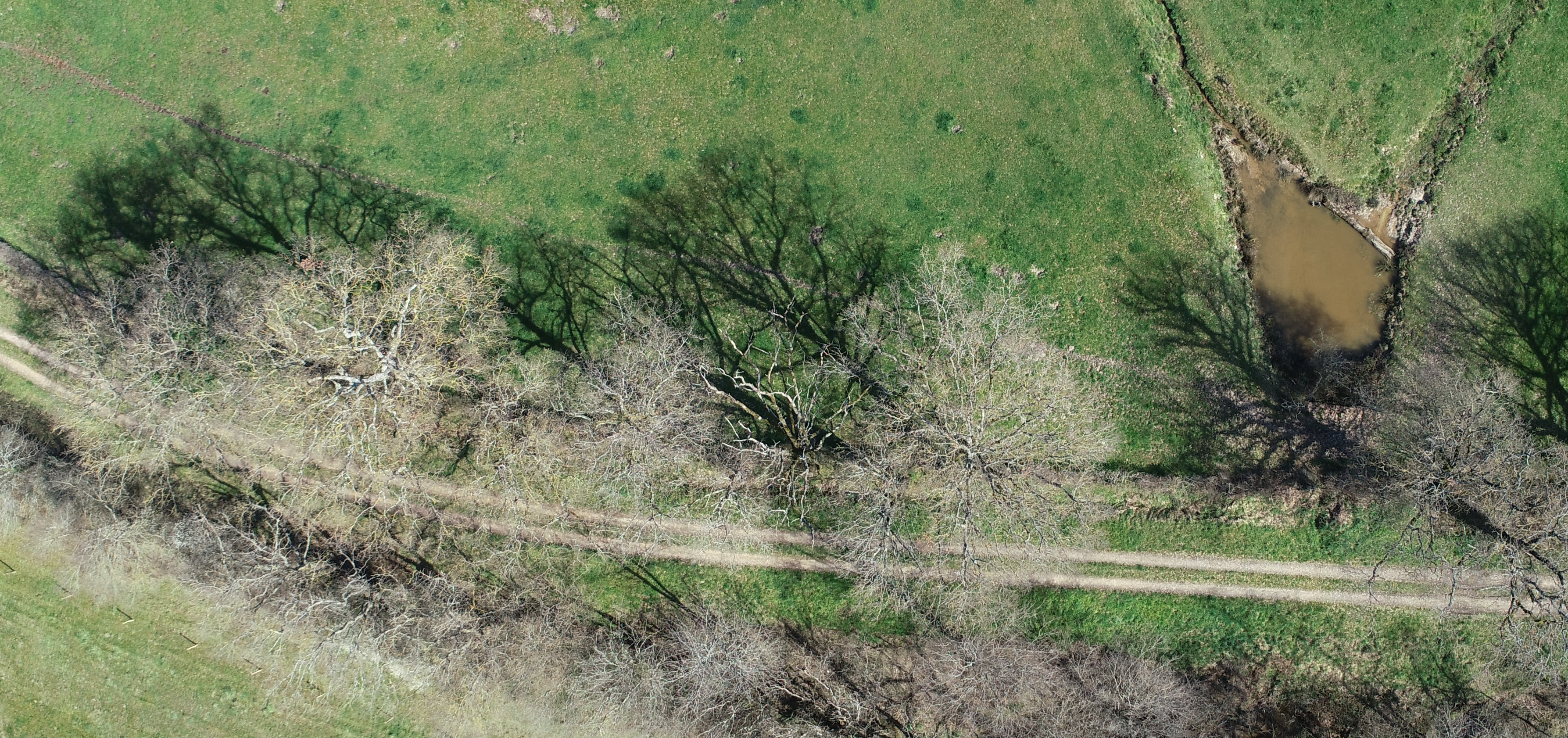
Terrain Mapping
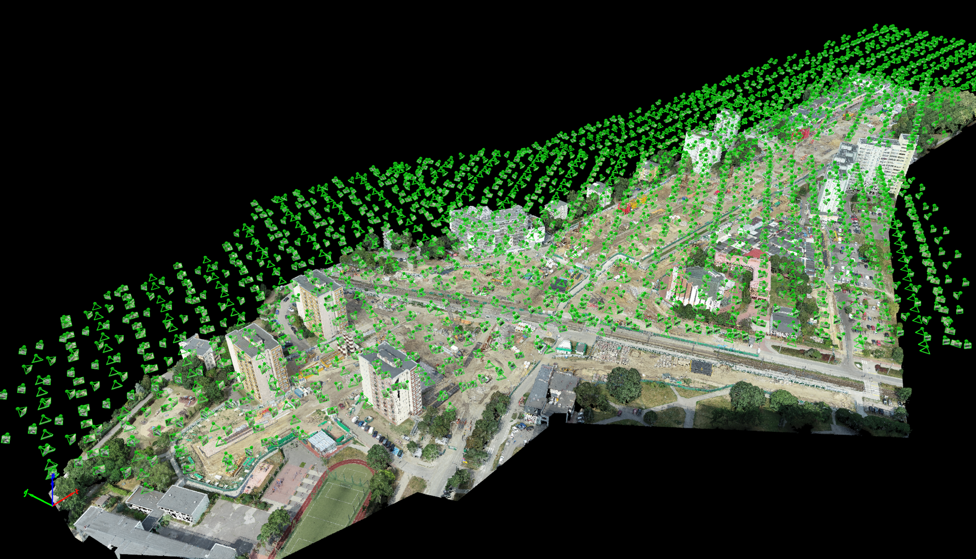
For terrain mapping we usually use Pix4D. Pix4D is promoting its newest software Pix4DMatic now, but for the moment Pix4dMapper is still our preferred software. It allows us to fiddle around with the settings to achieve the best results based on the type of terrain. With our standard Inflights Flight Plans we have come up with an excellent method to map terrains for DTM extraction, as well as objects and trees in the terrains that are not always straightforward to model in a point cloud.
For very large projects we sometimes do use Pix4DMatic as well. This seems to be the future of Pix4D anyway, but at the moment some simple features are still not implemented that are holding us back in using it more often. For example we can’t define a processing region, and there is also no picture manager as in Pix4DMapper that allows us to check the EXIF data of the pictures. Of course at Inflights we have our own datachecker that performs this part of the process. The quality report generated by Pix4DMatic is not yet very extensive either. Pix4DMatic is in promotion now till the end of the year, and allows a lifetime licence, but we have seen before with Pix4d that a lifetime licence does not mean much, as they offered that before with Mapper, to then stop the support and switch to (steep) monthly fees. The Auto-GCP function in Pix4DMatic certainly is cool for the specific projects it works very well on.
Pix4DMapper allows you to create an automatic DTM and contours, but this is a function we never use, as the algorithms are just not capable of doing what a knowledgeable survey engineer can do in specialised post processing softwares.
Roof Mapping
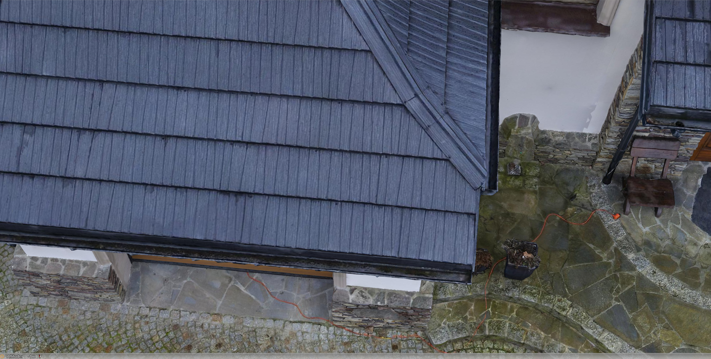
For roof mapping our preferred software is Agisoft. Agisoft has a quite advantageous lifetime licence. One of the main characteristics of roof mappings is that it is actually very repetitive. Our standard Inflights flight plan is producing very nice point clouds, which is the deliverable we mainly depart from when making further CAD models. In Agisoft we have set up and created an automated set of parameters, allowing us to run the photogrammetry process without much human interaction needed. Of course, automated systems are not perfect and we always have a team member cross checking the results.
Facade Mapping
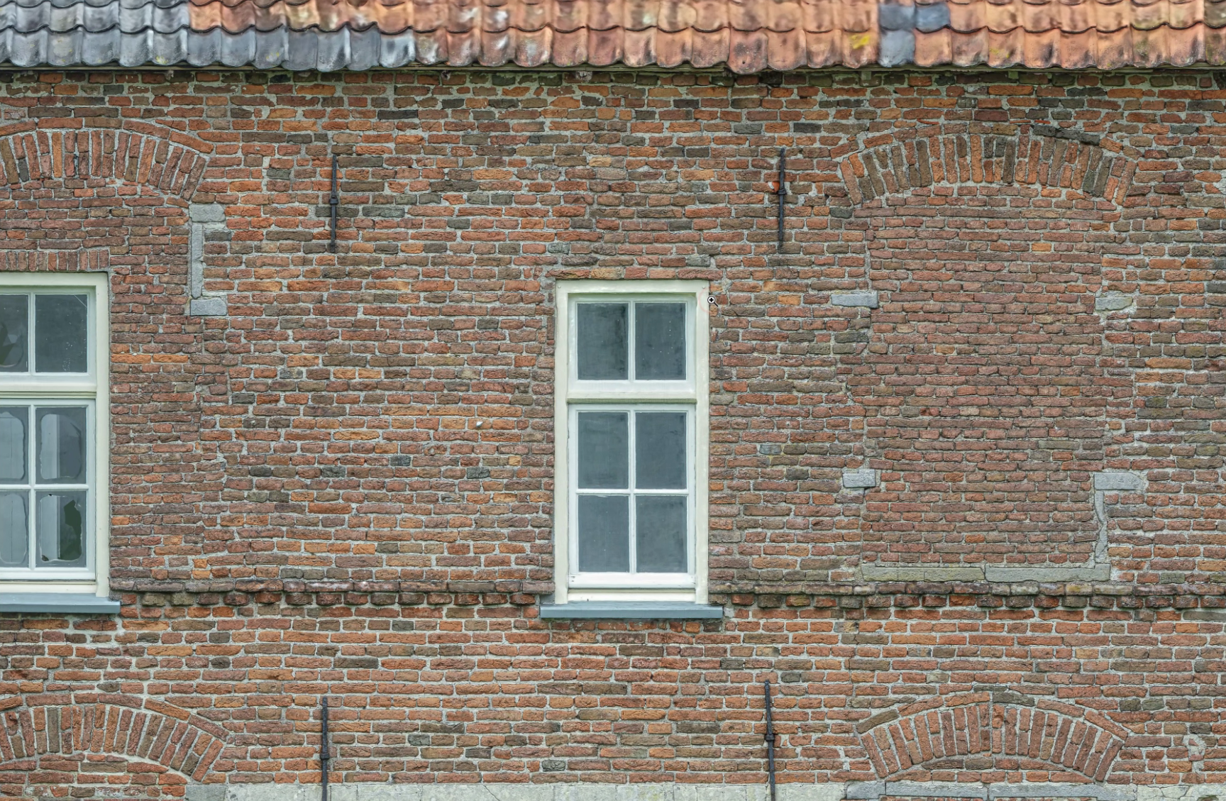
To map facades of buildings, we do it either in Pix4dMapper, or in Reality Capture. Reality Capture is giving a very nice orthoprojection, but it needs a few steps in between in order to make this orthoprojection readable in a CAD drawing. Reality Capture has the added advantage of their pay-per-input system. It allows you to run the process and create the end product, and only when you are happy with the result given by the software, you pay for actually exporting the results. It makes it a very accessible and affordable package to map facades. It also allows you to play around with the software without the need for trial licences.
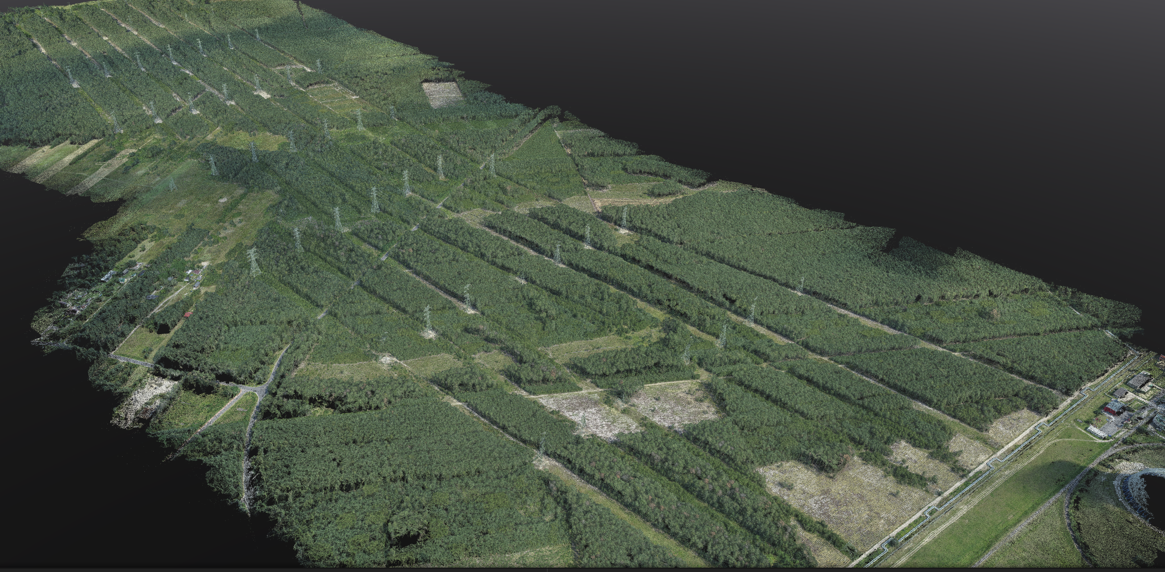
Power Line Mapping
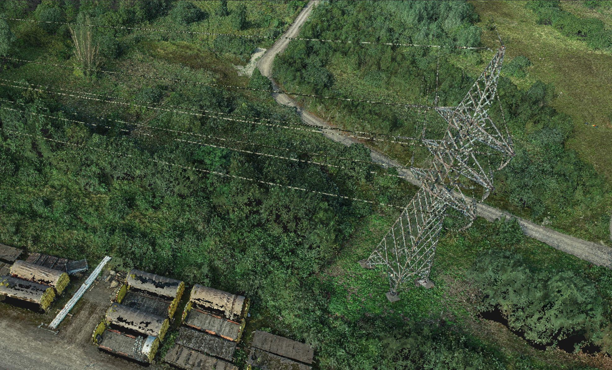
To map power lines usually we stick to Pix4DMatic. It is faster, and since we sometimes have to map miles and miles of power lines, the amount of pictures can add up very quickly. So here the main advantage of Pix4DMatic, which is speed of processing, is definitely an asset.
Textured Mesh
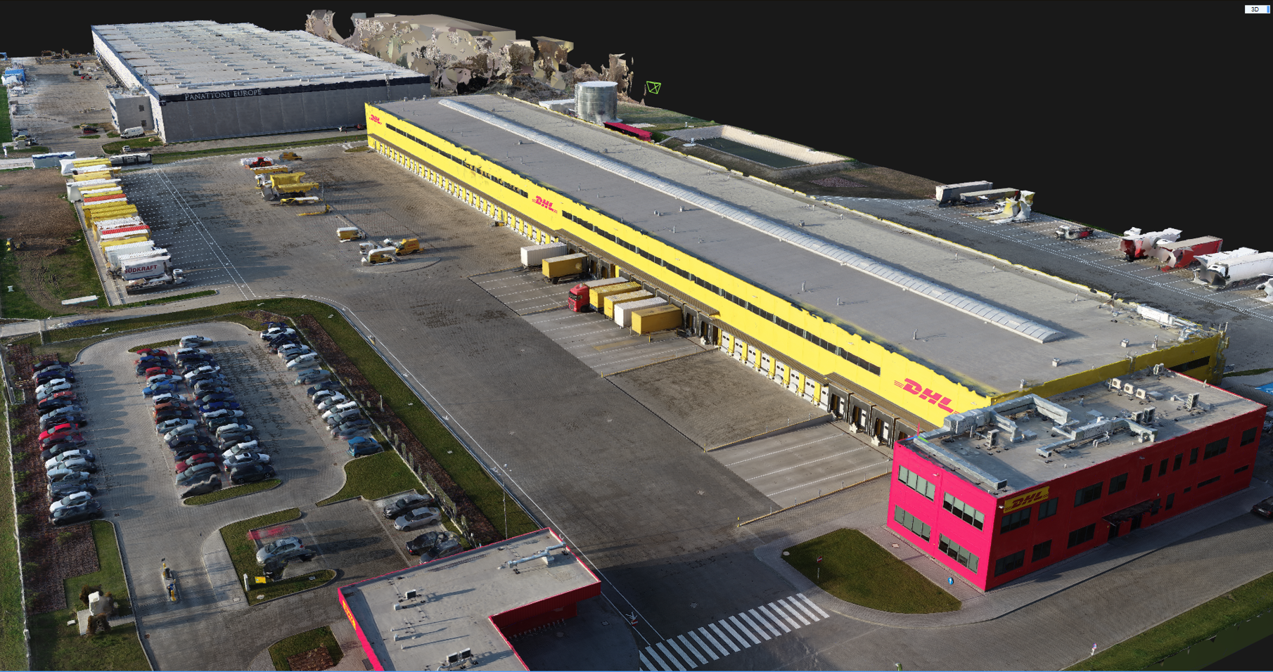
Making a mesh out of a point cloud is something all the programs do. Even with perfect point clouds, this mesh will never look perfectly well when created by most standard photogrammetry software packages. Usually our clients only use these meshes as a reference, and as a by-product of the photogrammetry. In case the mesh is really needed as an end product, we sometimes use Context Capture, which yields superior results, but the price is also very steep. Context Capture supports more different output formats, but it is quite slow compared to the other softwares if you are not using the cloud service. Our preferred software for textured mesh reconstruction is Reality Capture. It is among the fastest photogrammetry processing programs out there and the densified point cloud requires much less cleaning.
Each photogrammetry processing software has its own strengths and weaknesses, our processing team spent time and money trying to figure out the best workflow for each drone mapping product to deliver the best outputs to our clients - this makes us different among other drone mapping companies.