Analyze Unprecedented Detailwith Drone Topography
Create a digital twin of your terrain to optimize the placement of your solar panels. Get the full topography done in no time and use our vectorized drawing to further develop your project. Say goodbye to unforeseen obstacles. Use the model to calculate the impact of shadows during design phase.
Analyze
CAD Modeling of Terrains reinvented
Using drone data to do topographical surveys of terrains in a completely new way
3 cm resolution
Accurately see the obstacles on a terrain with high-resolution images.
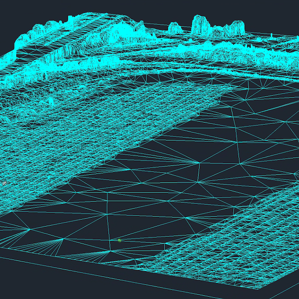
Digital Terrain Model
Combined with advanced machine learning algorithms, our engineers are able to separate the terrain from the vegetation to deliver a high-quality Digital Terrain Model (DTM).
Survey grade
Our survey engineers follow strict procedures to ensure the quality of our deliverables are survey-grade.
Accurate
All elements are modeled in the digital twin to a very high degree of accuracy. This way it can be used as the starting point for high precision design.
All obstacles modeled
All relevant obstacles that have an impact on the positioning of solar panel designs are modeled.
Universal Formats
Multiple file format outputs are possible to ensure you are able to integrate the deliverables easily.
CAD Terrain Drone Data Made Ready for Use
Increasingly more empty terrains are being converted into solar farms. Typically, terrains up to 100ha will need to be charted to prepare the drawings.
However, mapping terrains is not what it used to be. Traditionally, a surveyor would manually measure an enormous set of points, and their work stopped there. This of course is very time consuming, and results in steep surveying costs for larger terrains. Furthermore, the end product is incomplete.
At Inflights, we have the experience to map the terrain with drones in such a way as to generate a tailor-made product. We have worked with the engineering departments of solar panel installers to develop our Inflights standard of survey grade drone mappings.
We replicate this standard quality throughout all our drone flights across the globe and deliver the same end product no matter where in the world the terrain is located. Our survey team is 100% based in Brussels to safeguard this consistent quality.
Most design software is not geared towards using drone data yet. Large point clouds become almost impossible to use or view. In addition, sometimes vegetation or temporary objects need to be filtered out from the data to create an exact terrain model. We can transform this point cloud into a DTM and a DSM in a way that software can never do. We manually make sure that all important terrain features are represented as in reality.
Furthermore, we will vectorize your point cloud, and deliver you a CAD file specifically designed to meet your needs.
Compatible with most software used in solar
Importing a CAD model that is not compatible can take hours to decipher how to use it. Our processing team has tested the majority of software packages to ensure you can import it in seconds.


Deliverables
A standardized set of products ready to integrate into your existing workflow.
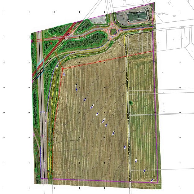
CAD Drawing
A CAD model (DWG) containing the Digital Terrain Model, the Digital Surface Model and the linework.
Digital Surface Model
The area of interest is approximated with 2D raster where each point stores the height of the highest point.
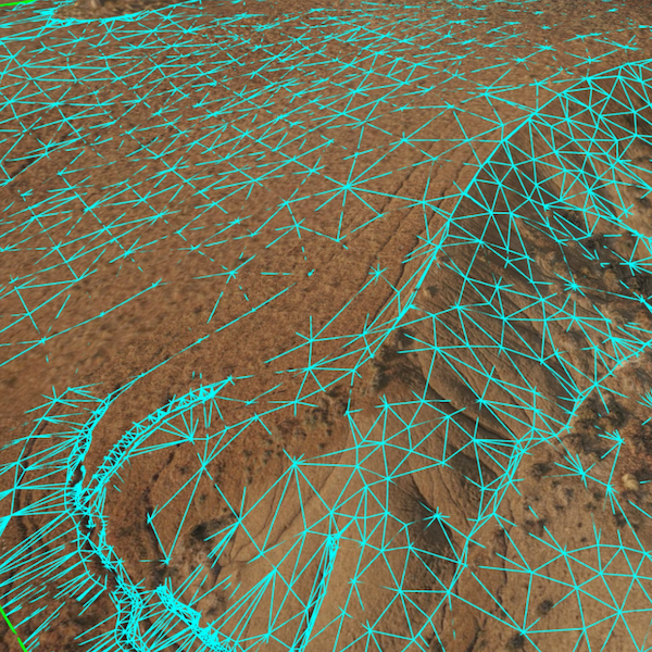
Digital Terrain Model
The area of interest is cleaned from vegetation and approximated by a set of triangles (TIN Surface).
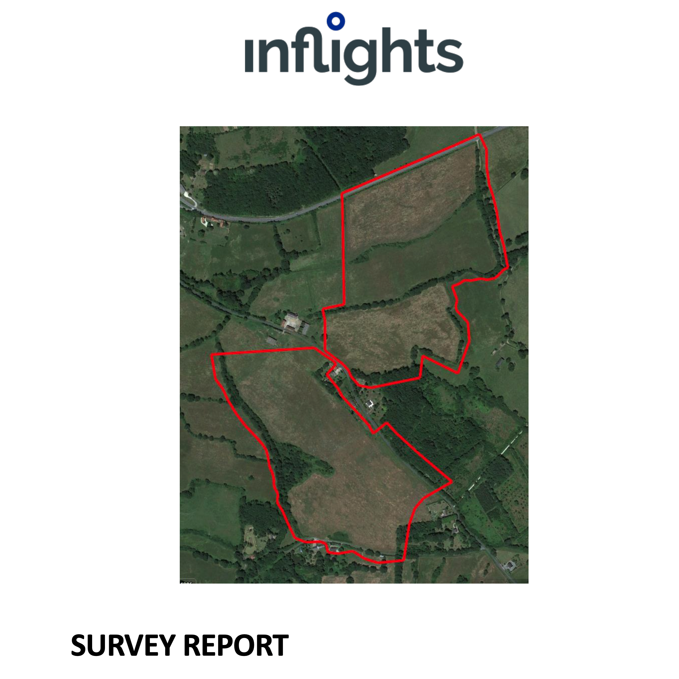
Survey Report
A report about the survey done, to validate the accuracy of the survey.
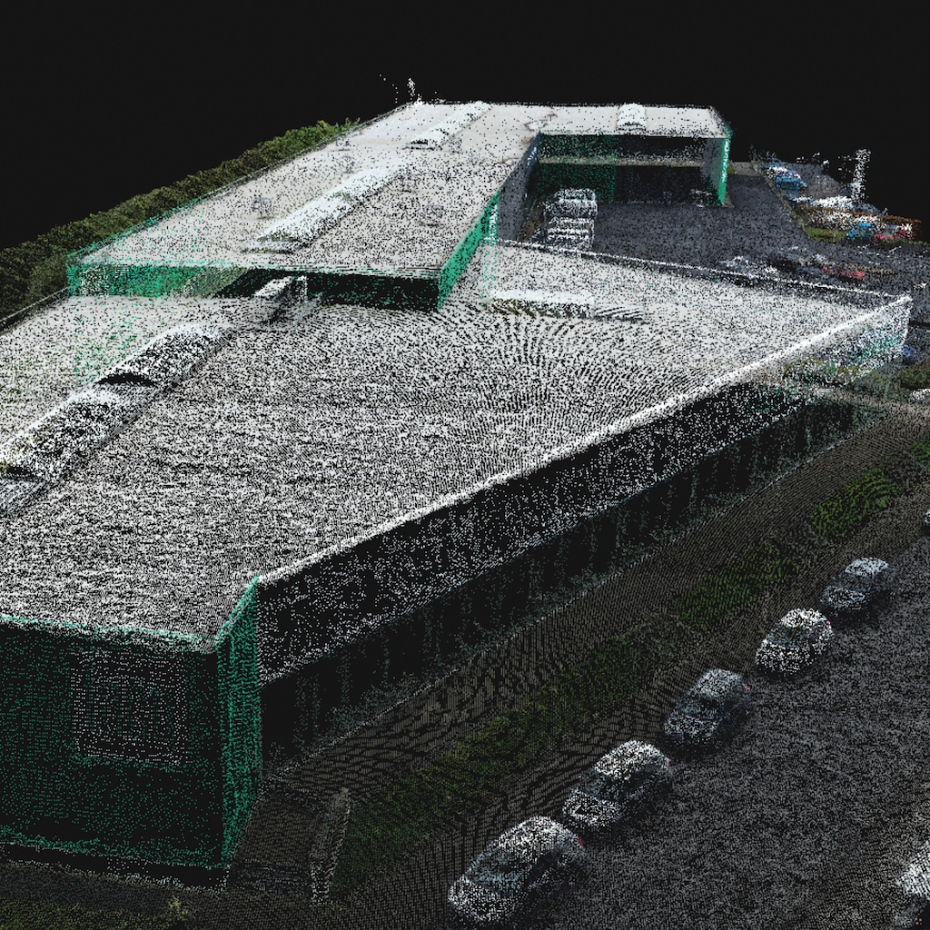
Point Cloud
The area of interest is modeled by a cloud of points in space, each with its own color and coordinates.
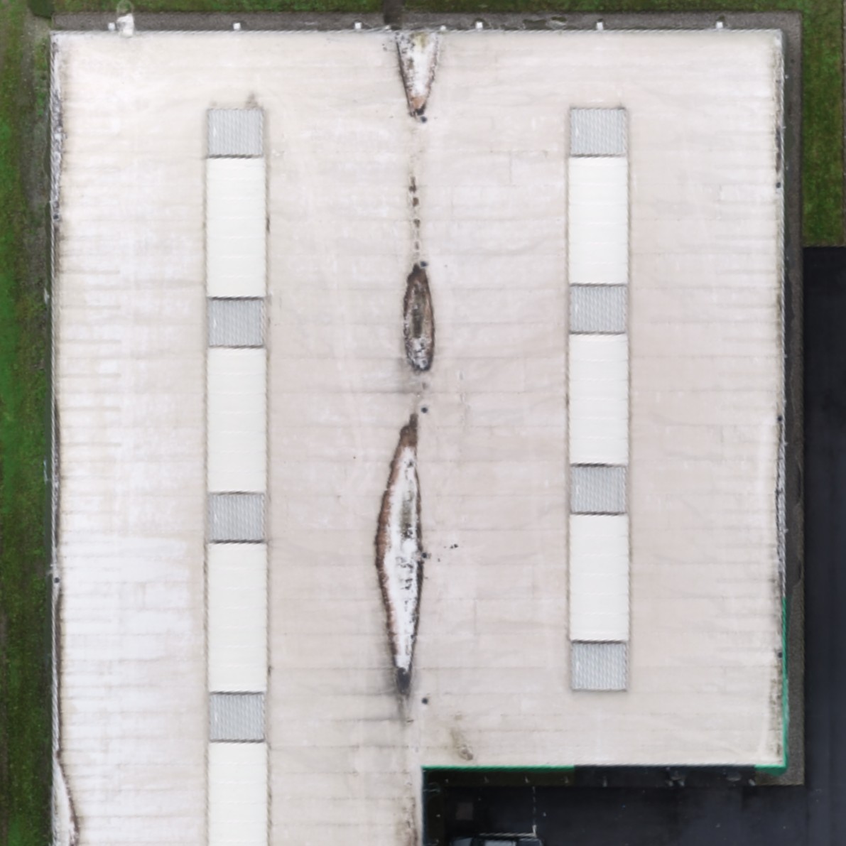
Orthomosaic
The area is represented by a photorealistic map. This map is made of rectified photos and synthesized into an accurate high resolution georeferenced image.
How it works
Our global pilot community and central team are ready to help you obtain the drone data for your project
Standardized process
-
Request your quote
- Upload the area to be mapped to the Inflights Platform or select an area on the map.
-
Get an instant price
- Our algorithms will generate the best price for you based on our pricing agreements with our pilot community.
-
Sit back and relax
- We ensure that all legal requirements are met. We keep you updated with all the critical steps in the process and inform you when the final deliverables are ready.
-
Download or View your results online
- View your deliverables online or use our ready-to-use files on your own software to start designing your site.