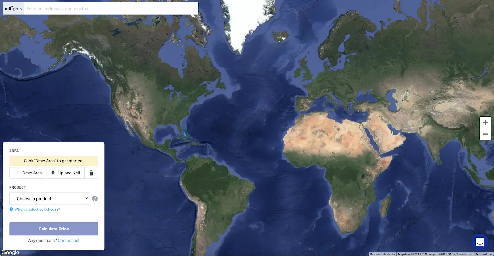
Where is your next project?We can fly there!
The integration between Plex-Earth and Inflights allows you to seamlessly integrate drone data in your AutoCAD project.
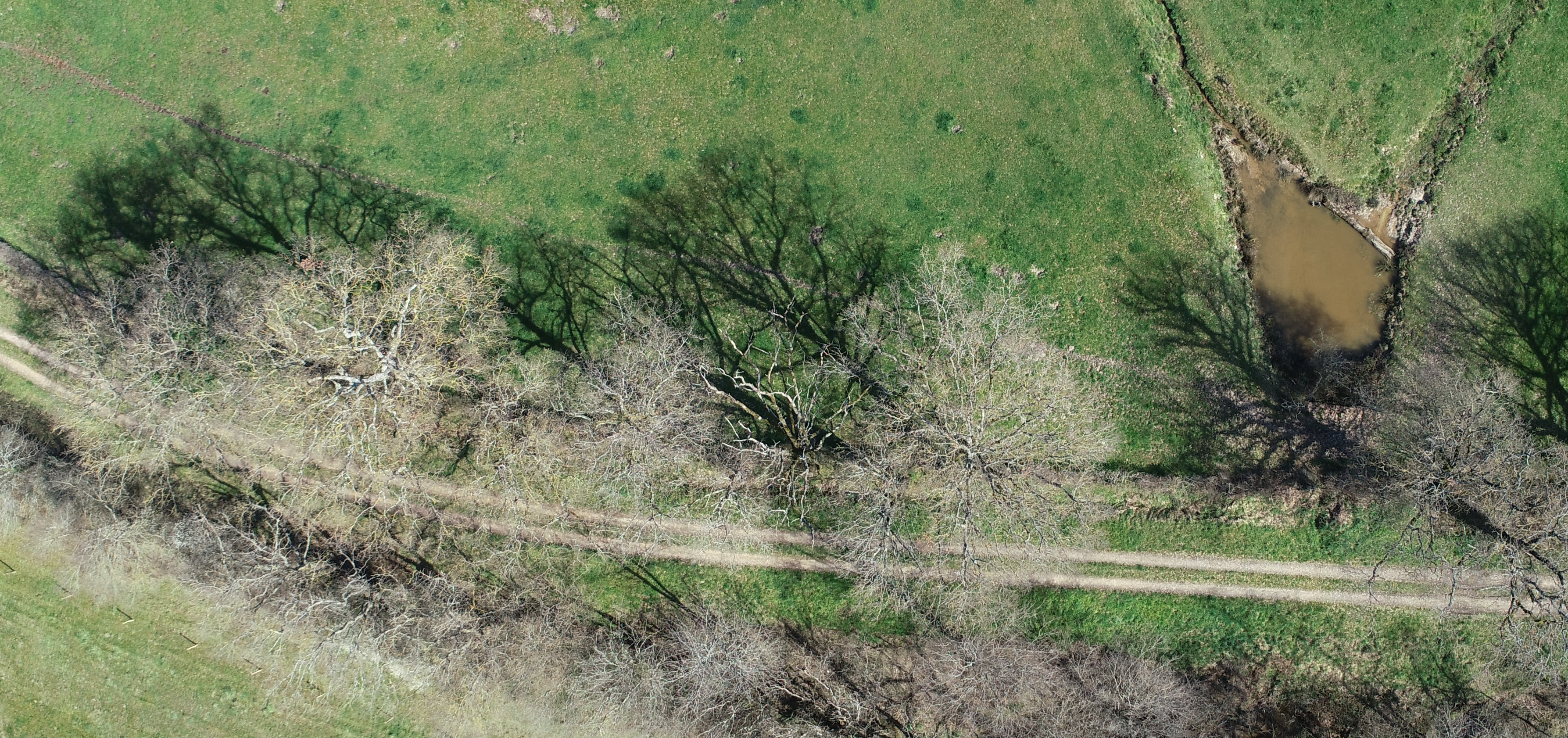
Drone Data
Why Drone Data?
Survey Grade
Our engineers follow strict procedures to ensure survey grade quality.
High Accuracy
All elements are modeled with a high degree of accuracy for precision design.
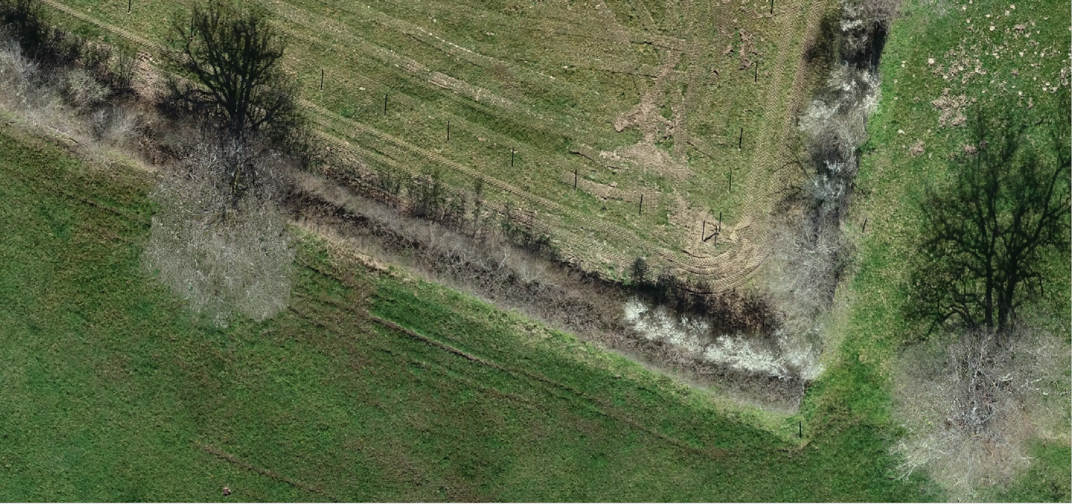
Resolution of 1 cm
Accurately see the obstacles on the roof with high-resolution images.
LIDAR or Photogrammetry
Choose between LIDAR or photogrammetry to get the best data for your project.
Global Coverage
Obtain drone data anywhere in the world with our global coverage.
Universal Formats
Multiple supported file formats to ensure you can integrate the deliverables easily.
Plex-Earth & Inflights Integration
Order Drone Data from within AutoCAD
- Obtain instant prices in your AutoCAD environment, just like when ordering satellite data.
Smooth end-to-end operations
- Smooth end-to-end operations managed by Inflights Operations Team.
Get a discount on your order
- Plex-Earth subscribers get a discount on their drone data orders via their subscription.


Deliverables
A standardized set of products ready to integrate into your existing workflow.
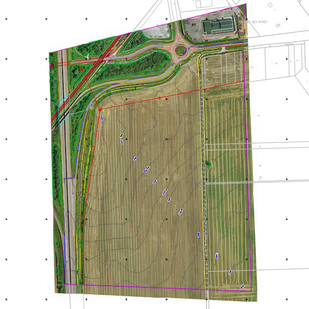
CAD Drawing
A CAD model (DWG) containing the Digital Terrain Model, the Digital Surface Model and the linework.
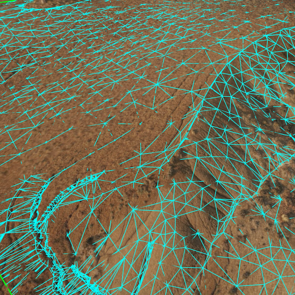
Digital Surface Model
The area of interest is approximated with 2D raster where each point stores the height of the highest point.
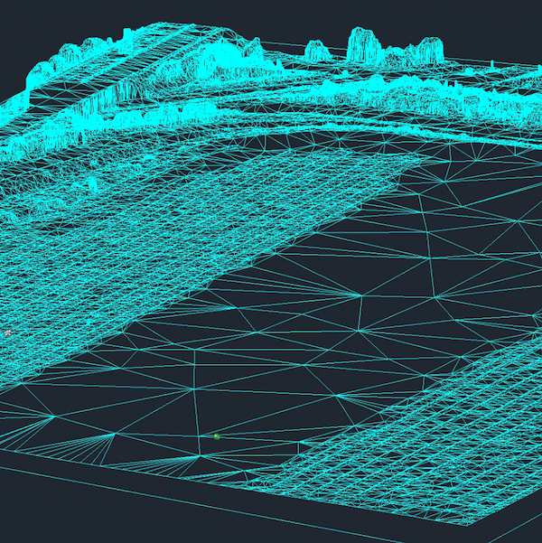
Digital Terrain Model
The area of interest is cleaned from vegetation and approximated by a set of triangles (TIN Surface).
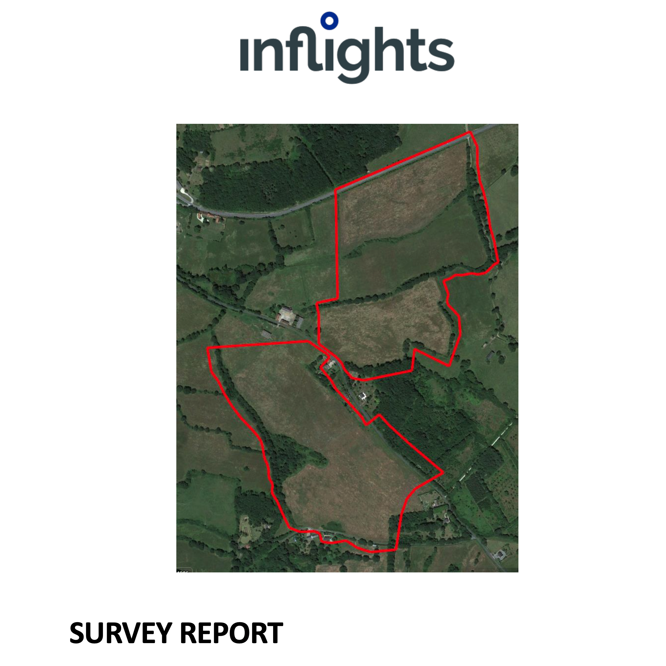
Survey Report
A report about the survey done, to validate the accuracy of the survey.
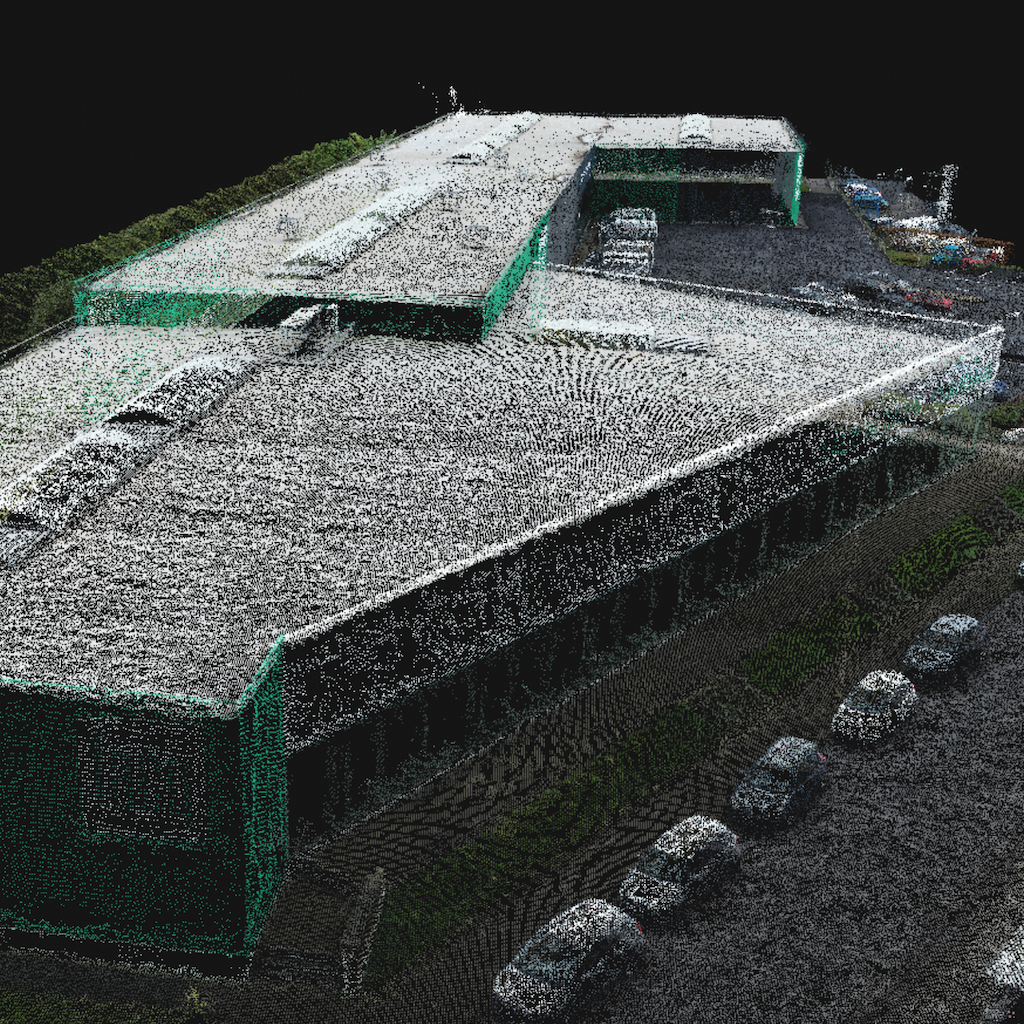
Point Cloud
The area of interest is modeled by a cloud of points in space, each with its own color and coordinates.
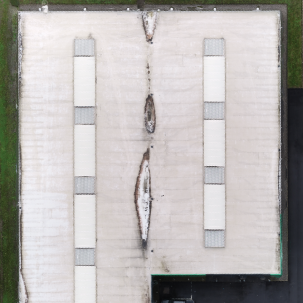
Orthomosaic
The area is represented by a photorealistic map. This map is made of rectified photos and synthesized into an accurate high resolution georeferenced image.
Obtain
Instant quotes at a global level
For our valued customers we aim to provide instant quotes, so they know immediately how much their project will cost. Just upload your project area or coordinates into our Platform, and obtain your quotes in seconds.