When you order a drone survey, one of the files you will receive from us is a
point cloud and usually has a .LAS extension. As the name suggests, this
file contains a cloud of points. Each point has 3D coordinates and
optionally an associated color. This allows it to represent any real-life
object digitally. Hence, it is often called a "digital twin". As we will
explain below, point clouds play an important role in drone-based surveying.
They are cost-efficient
With the invention of drones, obtaining high density point clouds has become easier than ever. While traditional land surveyors may measure a point every 20 meters, with a drone, you can have a point every centimeter through the usage of photogrammetry or LIDAR scanning
Performing the survey with a drone drastically reduces the time needed to get measurements. Additionally, you do not have to worry about hard to reach areas, as might be the case with certain roofs. As a result, the complexity of project will not drive the measurement time as much as it did with traditional methods.
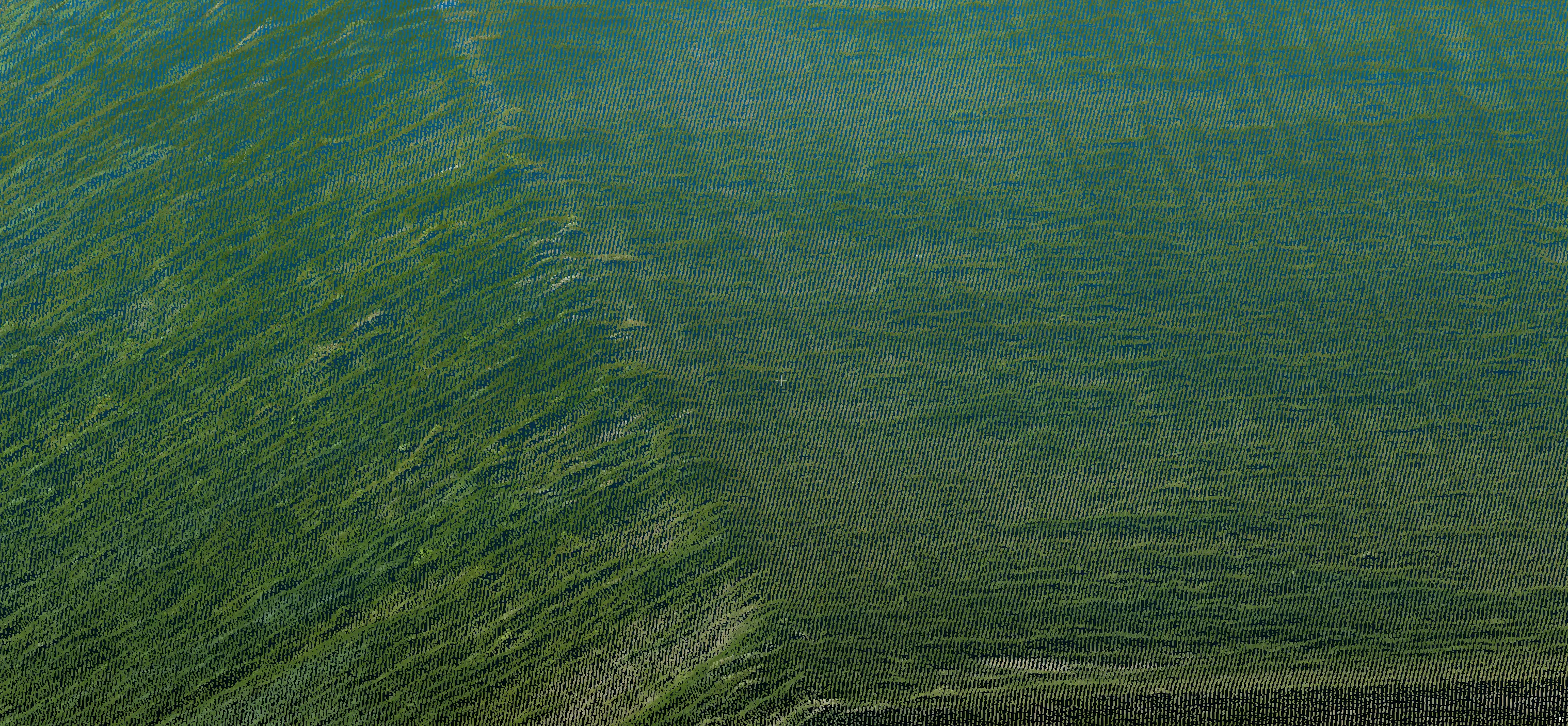
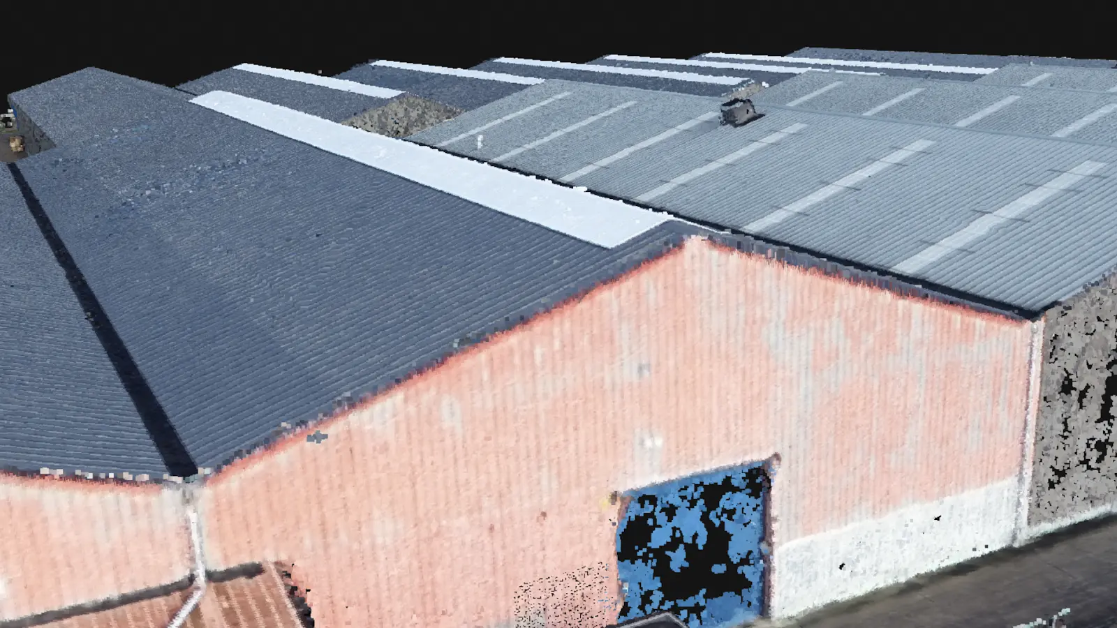
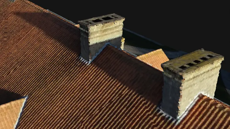
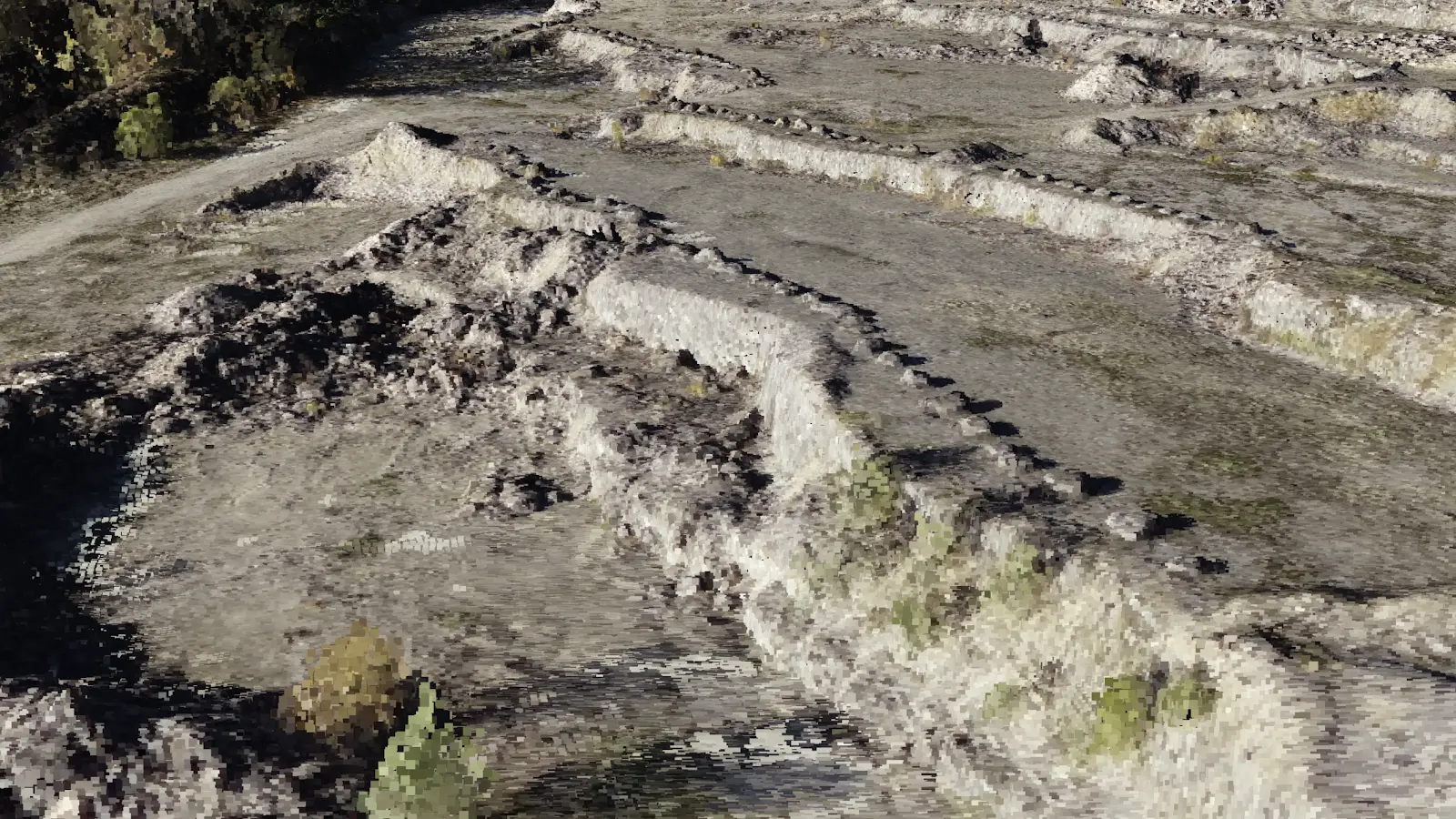
They are highly detailed
The substantial increase in resolution you get is especially attractive when modeling terrains and roofs, because it gives you a realistic copy of the environment with all details included.
For terrains, the point cloud models detailed topographic information, such as rocks, slopes, and vegetation. For roofs, all obstacles and slopes are included and measurable.
Below are a few examples to illustrate the amount of detail that a point cloud contains:
They are a great foundation for other deliverables
Depending on the stage of the project, the amount of detail that is captured in a point cloud can be too much. This is why we also offer to transform the point cloud into a CAD model, with accurate measurements and only the information that you need.
When creating this point cloud, it is important to use the correct coordinate reference system. This ensures that it is usable with other applications, which may want to use that information to place it on a map. Even more importantly, it also ensures that the model is scaled correctly for taking measurements.
Internally, we also use the point cloud to produce a digital elevation model and a 3D mesh, which we will cover in more detail in later blog posts.
They are useful for inspection and presentation
The benefit of having a highly detailed digital twin, such as a point cloud, is that you can easily inspect details after the fact and decide to change the level of detail (LOD) after the measurement.
On top of that, it just looks really cool! We see our clients using it as a starting point to present their plans. Showing where there are trees, neighboring constructions, or displaying the elevation profiles, can be all done via an online viewer. Their rich representation gives you a better perspective on how things look in reality than a traditional survey does.
Bonus: How to view a point cloud
There are various ways to view a point cloud and they don't necessarily need paid software.
If you ordered a flight via Inflights, we will even include an Online Viewer so that you can see the point cloud in your browser. Click here to see an example.
If you would like to open it on your computer, then
CloudCompare is a great free option.
QGIS, a free GIS application, recently
added support for viewing point clouds too. Both of these applications are
able to open .LAS files.