Roof Mapping with CAD
Accurate roof measurements and CAD-ready data for fast, reliable rooftop PV design.
Deliverables
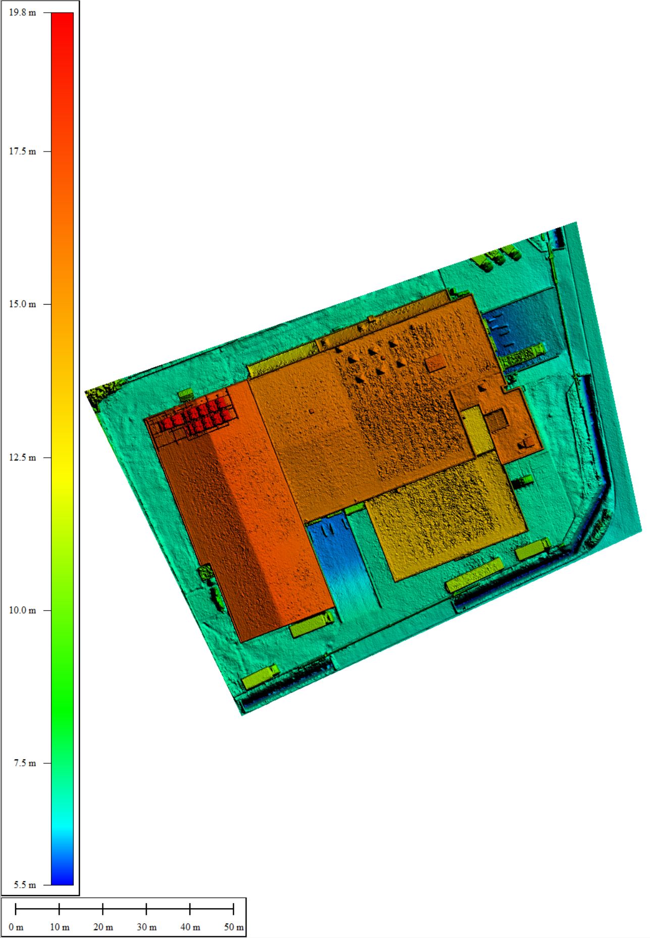
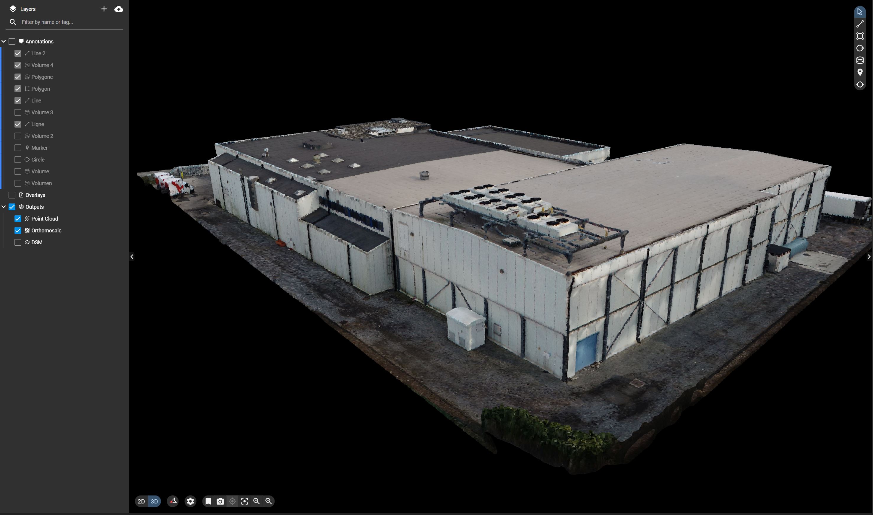
The standard specifications for our roof mapping with CAD deliverables are 1.5 cm GSD resolution and 2 cm relative accuracy in XYZ. All deliverables are provided in formats compatible with standard inspection, reporting and asset management workflows.
See it in action
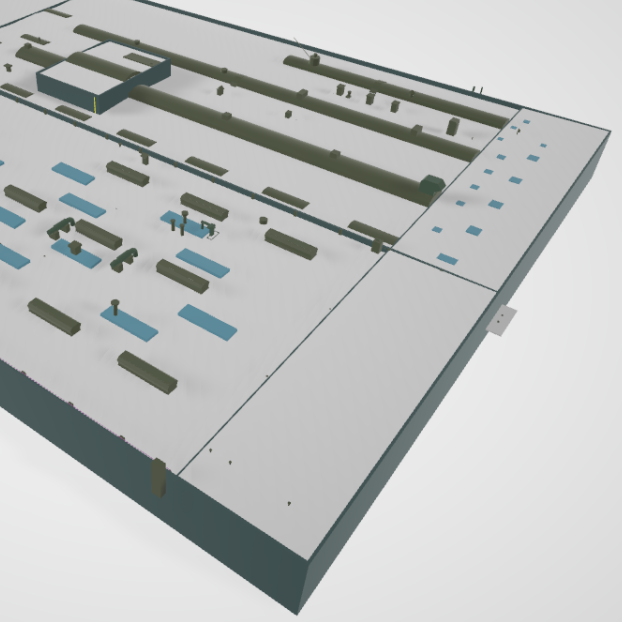
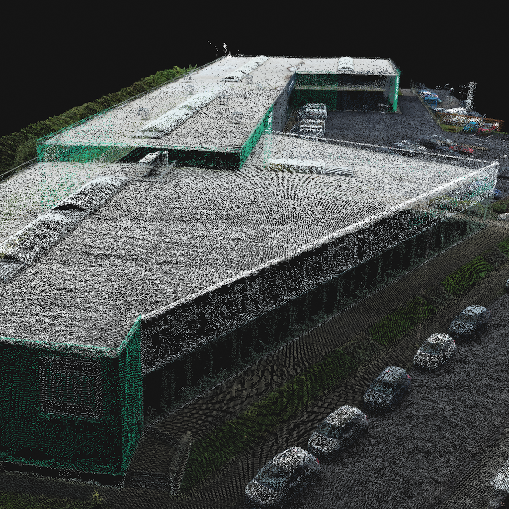
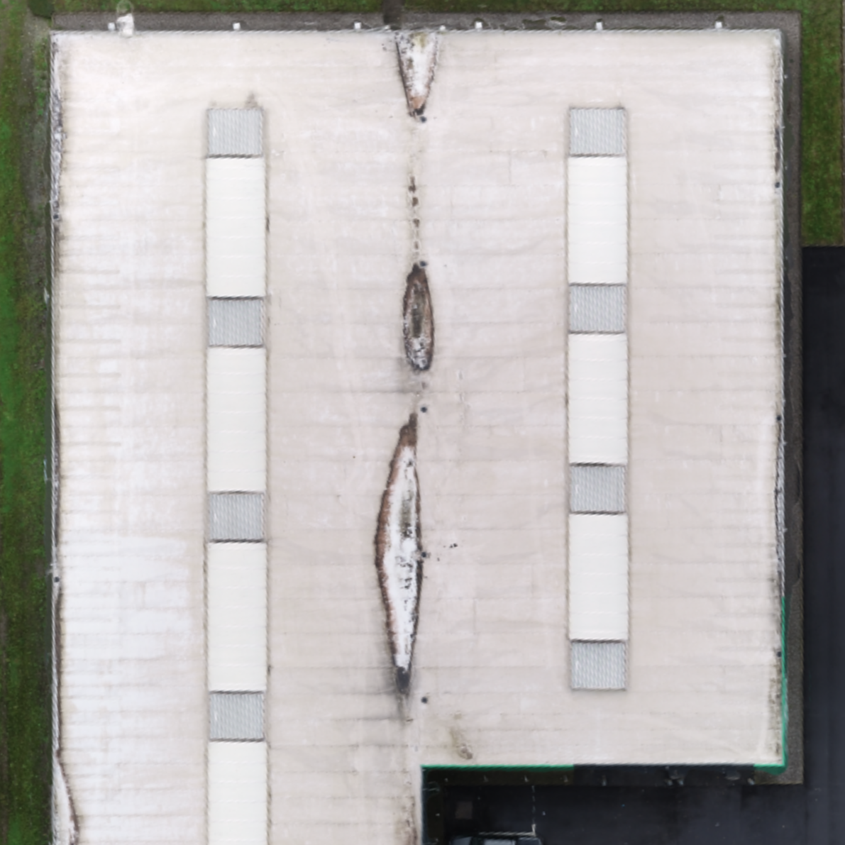
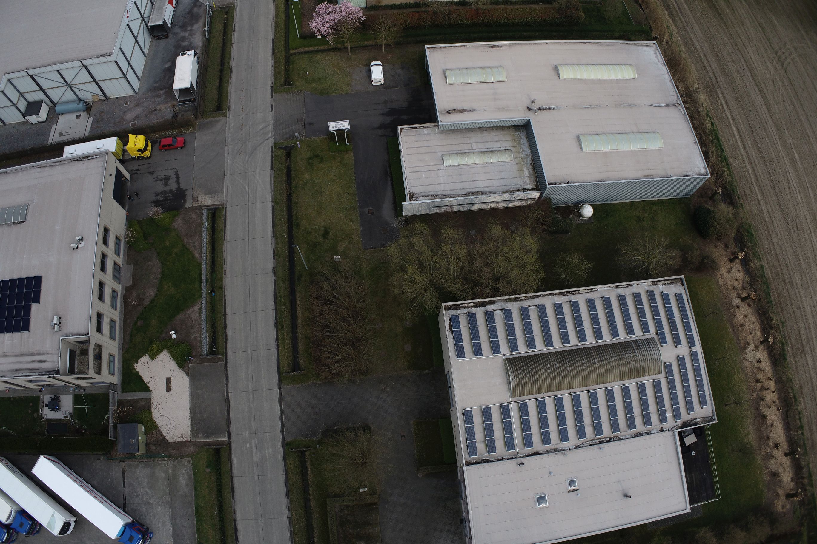
From drone data to final deliverable.
Pricing
All-inclusive. Exact price depends on location and terrain.
About this insight
Designing rooftop PV systems often relies on outdated plans, manual measurements or incomplete data. This leads to design iterations, site revisits and avoidable delays. Roof mapping with CAD replaces those manual measurements with precise drone data and delivers CAD-ready outputs that design teams can use immediately.
Standard specifications: 1.5 cm GSD resolution.