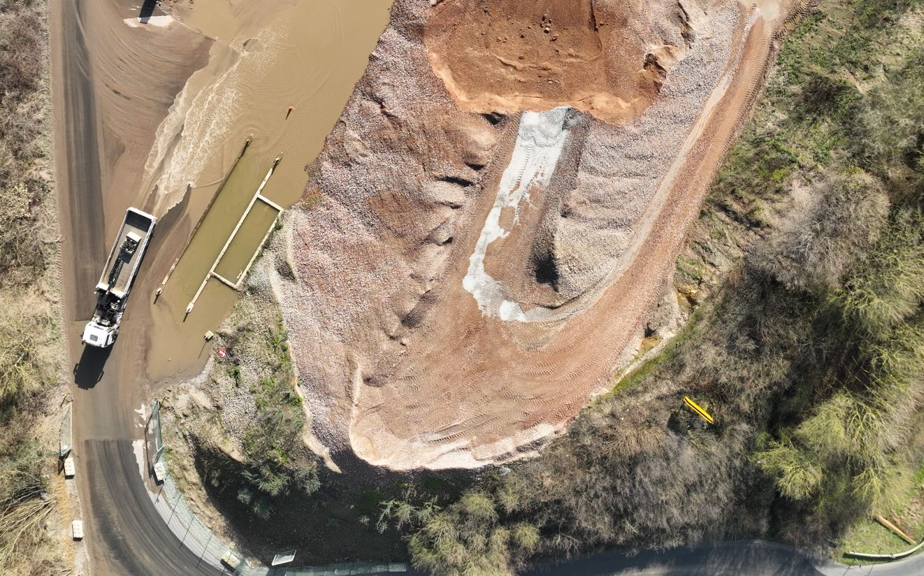
Stockpile Volume Calculation
Accurate volume measurements of stockpiles using drone data to support inventory management, planning and reporting.
Deliverables
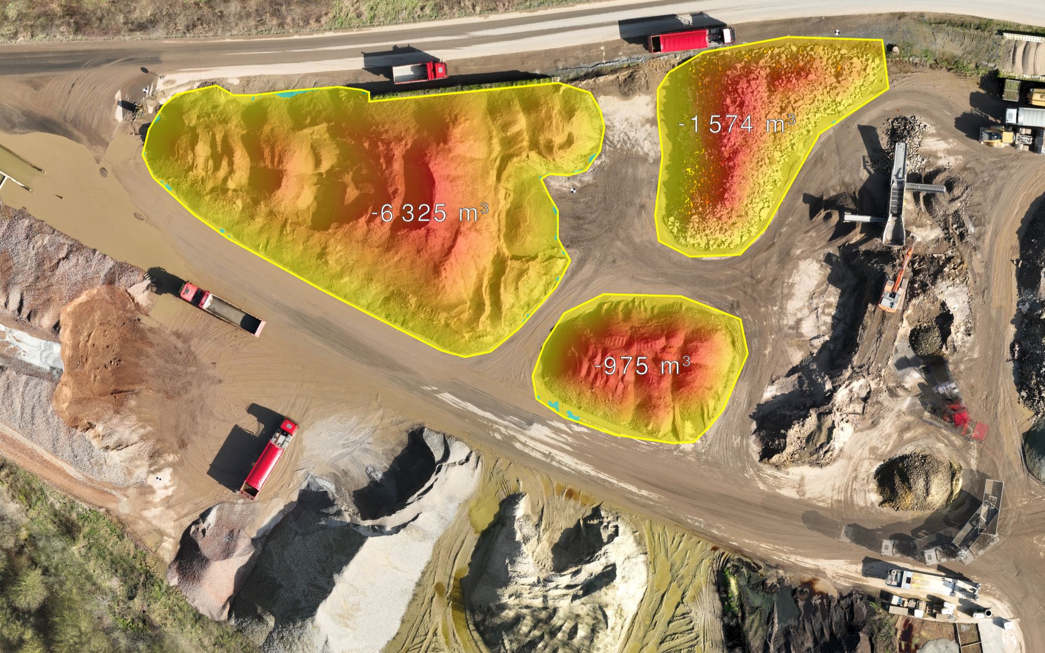
Stockpile Volumetric report
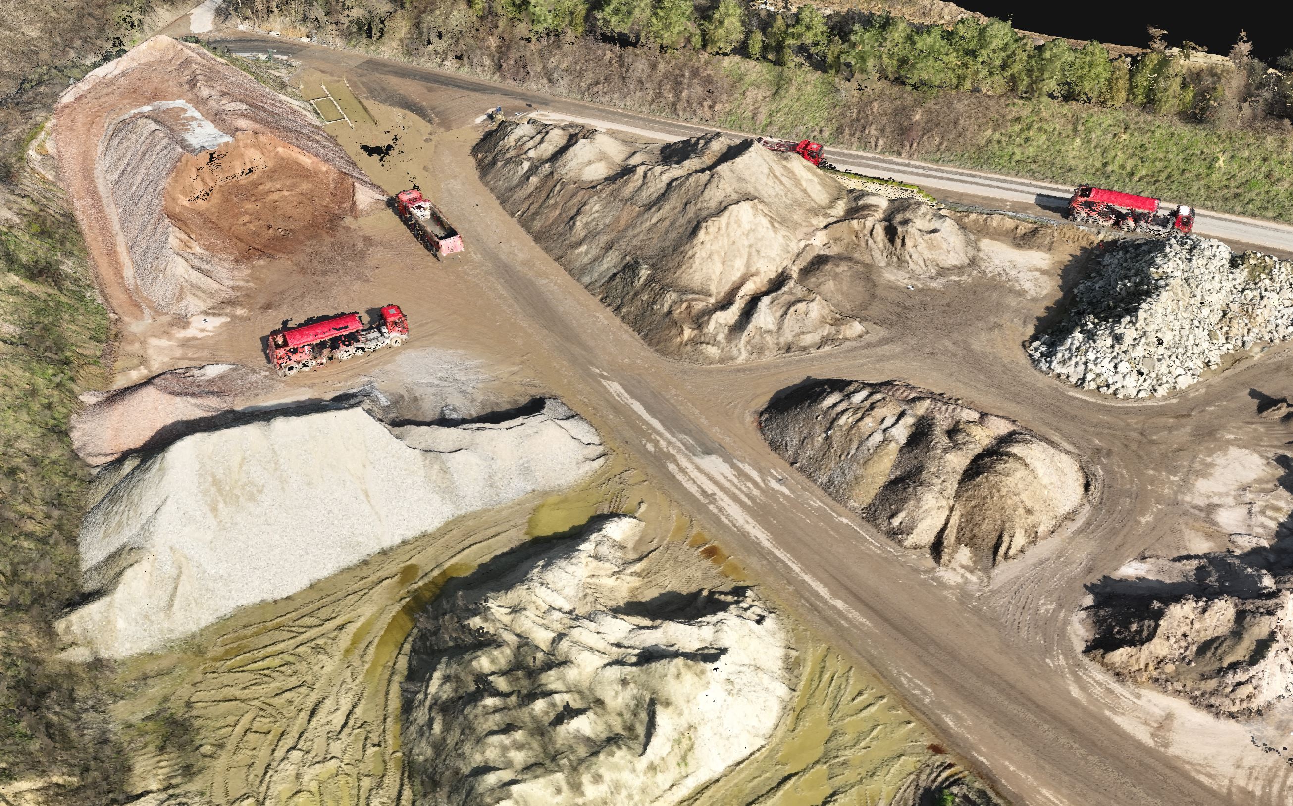
Point Cloud from Photogrammetry - 3D
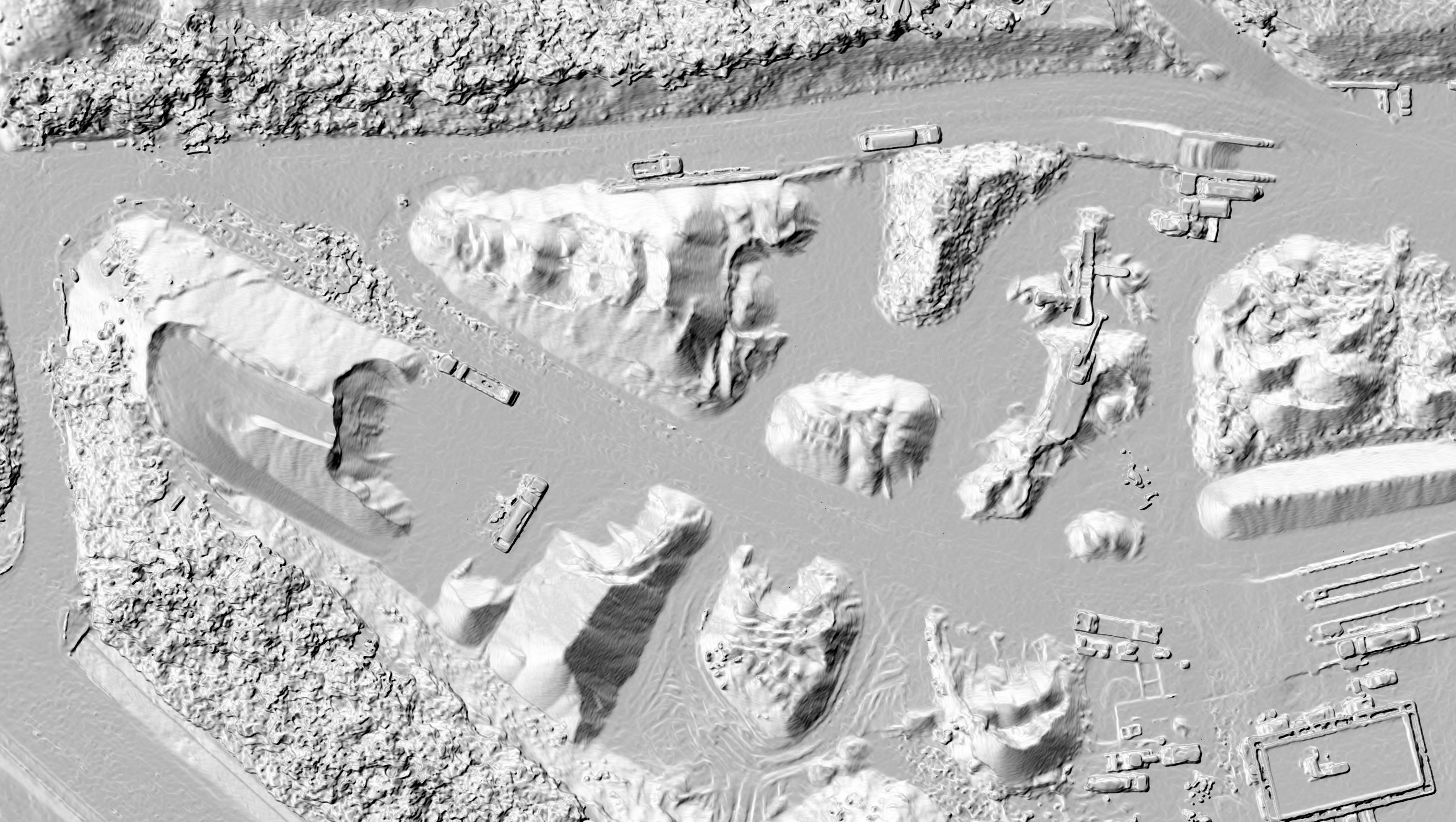
Digital Surface Model - 2.5D
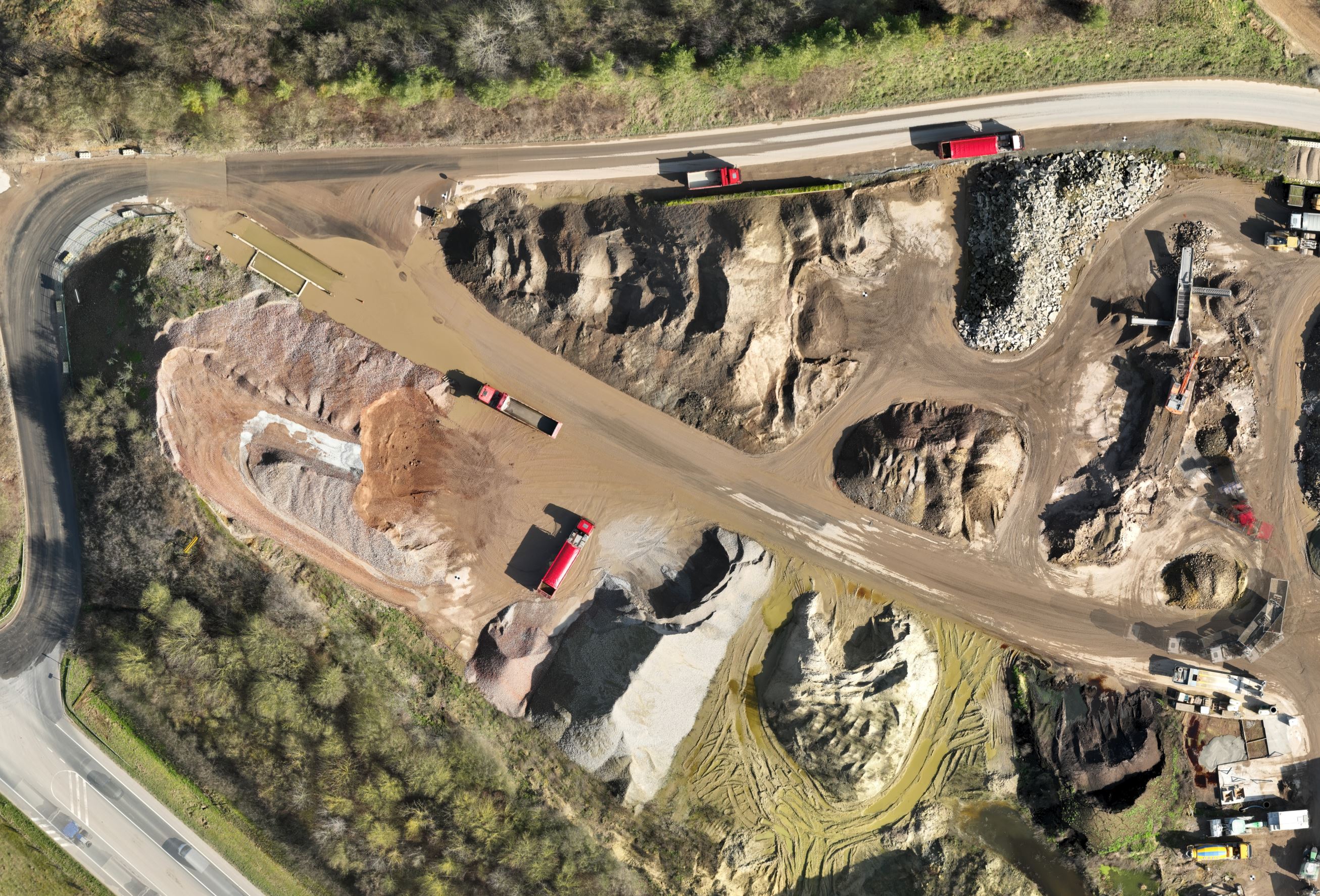
Orthomosaic - 2D
Unprocessed Pictures
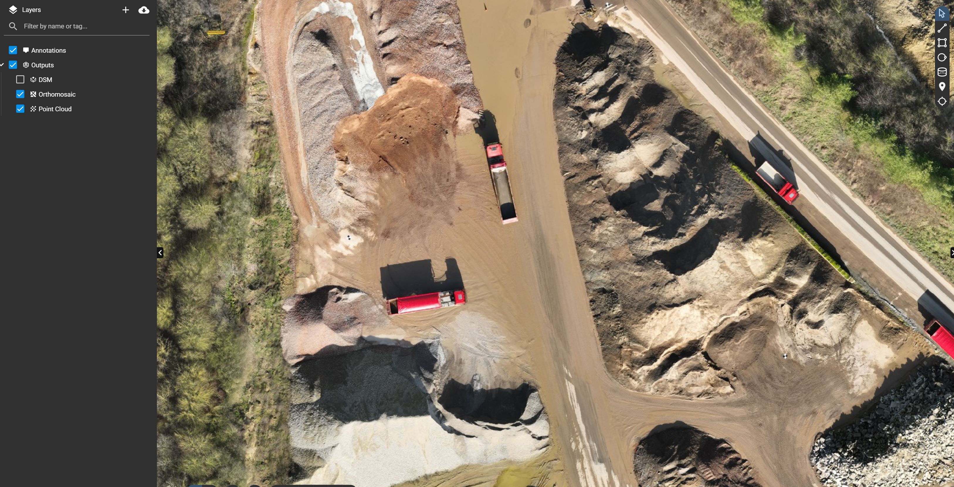
Web Viewer
Deliverables are designed to provide accurate volume measurements and integrate easily into reporting and operational workflows.
See it in action
From drone data to final deliverable.
Pricing
Area
Est. Price
0.1 ha
€ 1,073
0.5 ha
€ 1,073
1.0 ha
€ 1,073
3.0 ha
€ 1,125
5.0 ha
€ 1,177
10.0 ha
€ 1,438
50.0 ha
€ 3,000
All-inclusive. Exact price depends on location and terrain.
About this insight
Measuring stockpile volumes manually can be time-consuming, unsafe and prone to inaccuracies. Drone-based photogrammetry provides a fast and reliable alternative by capturing high-resolution data and transforming it into precise 3D models. This enables accurate volume calculations and consistent monitoring over time — without disrupting operations.
Standard specifications: 2.0 cm GSD resolution.
Typical use cases
Inventory management and stock monitoring
Accurate volume calculation for bulk materials (e.g. aggregates, soil, waste)
Planning and optimisation of storage and logistics
Reporting for operations, finance or compliance